
BayernInfo Maps.
Always in your pocket – always informed
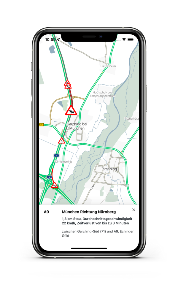
BayernInfo Maps is a free-of-charge mobile application which included a route planner cars and public transport. A good knowledge about road works, blocked roads and other travel restrictions helps you safe time and money.
- Map on the current traffic situation including a route planner
- Road works and blocked roads
- Danger warnings, congestion, restrictions
- Live traffic cameras on highways, in cities and on rest areas
- Live occupancy for truck parking spaces on rest areas
- Live occupancy for car parking spaces
- Public transport stops and POI in your area
- POI search
- Real-time data for public transport


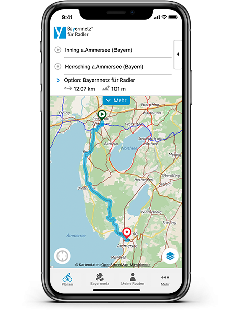
Bavarian Network for Cyclists
Your guide to discover Bavaria by bike
Discover the diversity of the fascinating nature and culture in Bavaria along the 120 family-friendly long-distance bike routes on more than 9.000km! On the bike pages you can find detailed descriptions of the bike routes, accomodation, points of interest and maps.
- 120 long-distance bike routes with detailed info
- Route planner for bikes including via points
- Height profiles, sights
- Bike-friendly accomodations
- more than POIs
- Offline maps and aerial maps
- Position tracking
- Save function for your favorite tours